Because of email size limits, this essay is best read on the web version or in the substack i0S app. To read the web version from email click the post title above. To get the app, use the button below.
The Rhine is so low that it may soon shut down to all shipping traffic. The Danube also. The Loire is so dry that you can walk across it. The Po has already been that low most of this summer, revealing sunken ships and bombs from World War II. Low waters have revealed hunger stones on the Rhine, the Danube, and the Elbe. All the grassland around our house is brown. Trees have died from the drought here, and almost all the nearby stream beds are dry. A significant part of one my favorite forests in France has gone up in flames.
There are stories here, more stories than I know, more stories than I can tell. For most, these places and these events probably sound mythic and distant. They once would have for me before I lived here. What is happening seems unreal still to me, even as I watch it happen, staring at the empty streams and parched land.
I. The Mothers of the Waters
Two weekends ago, my husband and I traveled to see members of his family in the Netherlands, his father’s ancestral home. It was our second visit together, this time occasioned by the birthday of his hilarious and exceedingly lovable aunt. The land where she and her family live, and where his father was born before leaving to find work in Luxembourg, is called Limburg. Most known for the city of Maastricht and associated with a rather strong-smelling cheese cultivated with the same bacteria that causes bad foot odor, Limburg is one the many places within the Ardennes which somehow resisted the mono-cultural drive of Empire and Capital.
Limburg juts out south from the rest of the Netherlands as a thin peninsula into Belgian and German territory. It was once part of Belgium, just as Luxembourg was, and the land itself is unique compared to the rest of country. It’s quite hilly, since it is part of the Eifel mountain region. It is also at the very edge of older borders of the Ardennes, meaning we didn’t actually leave the forest (or what was once all forest) to visit them.
To understand a bit what this is all like for me here, think of Appalachia in the United States. Depending on who you ask or where you’re from, your idea of what constitutes Appalachia is invariably different. The reason is of course that the Appalachian mountains occupy a very large area of land, or, put a better way, many artificial human constructs called “states” occupy parts of Appalachia. For instance, consider this map, which is an administrative map of Appalachia according to county.
This map is merely a political definition of Appalachia according to “cultural” districts, with political counties also marked. Most often it’s only the lavender section that most people think of as Appalachia, an area occupied by the political construct called “West Virginia.” I was born in that same area, though in the imagined place called Ohio, just near the imagined border of West Virginia, and lived most of my childhood there.
But here’s a different map, one of the actual mountains themselves without any of the political borders:
The actual mountain range of Appalachia is much larger than the political definitions, and also includes land occupied by Canada (Quebec, New Brunswick, and Nova Scotia, particularly), not just the United States.
It’s a bit similar to the Ardennes. Here’s a map I created approximating the way I understand the Ardennes now:
However, my map would be considered much too big by some, because the large swathe in Germany is instead called the Eifel. Here, it’s very similar to the question of whether or not one thinks the Allegheny Mountains are part of Appalachia. They are indeed all part of the same mountain chain, but the Alleghenies are a particular part with a particular meaning. Likewise, the Alps extend through Italy, France, Germany, Austria, Liechtenstein, Monaco, Slovenia, and Switzerland. Each country has its own feeling for the Alps, its own idea of what they constitute.
It’s all just a question of meaning, really, meaning created culturally from ancient land forms predating humans and their meaning-making.
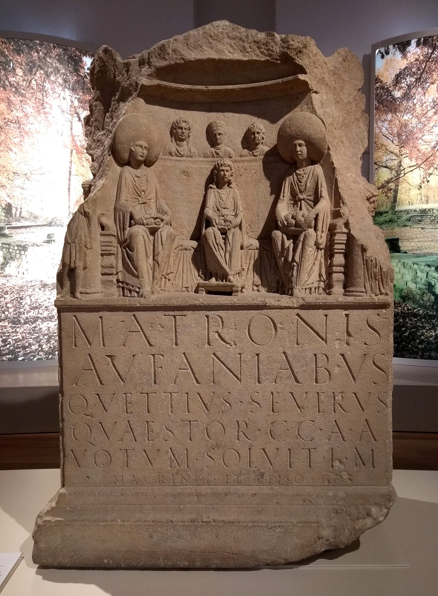
The distinction between the Eifel and the Ardennes is also a cultural one, going back to Roman and then Frankish times. An area much larger than the one I have demarcated, including all the mountainous regions to the east cut off my my map, was considered the Silva Arduenna (Forest of Arduinna) by the Romans. Arduinna, as you probably know already, was the name of the Celtic goddess of the forests here. On the other hand, the Germanic peoples in what is considered the Eifel worshiped a triplet of goddesses (the Matronae, or “mothers”) known as the Matronae Aufaniae, likely “mothers of the waters.” That name, Aufaniae, is one of the suspected roots of the word Eifel. Eifel was the regional named used by the Franks later as an administrative district (Eifelgau, which was next to Ardennengau).
Drawing hard distinctions between the Germanic and Celtic areas in this region isn’t really possible, though. Often times the assumed cultural boundaries follow political borders drawn up and imposed by the Roman Empire. The Celtic Treveri, who lived in what is both the Ardennes and southern parts of the Eifel, lived just adjacent to Frankish migrants who eventually also settled Treveri lands and intermixed with the people there. To the west and southwest of both these peoples were the Celtic Mediomatrici tribe. Their Romanized name means “of the middle mothers.” These mothers were likely goddesses (Matronae) of the rivers which passed through their land: the Meuse, the Moselle, and the Saar.
The latter two of those rivers (or mothers) join together with the Rhine, which runs through lands now considered the Eifel. The first river, the Meuse (or Maas in Dutch) also joins with the Rhine before flowing out to sea. However, by then the Rhine is no longer called the Rhine, but rather three smaller branch rivers that split off from its mother.
In fact, the Netherlands is essentially one large delta for the Rhine (and to a lesser extent the Meuse.)
The veneration of three mother figures by both Celtic and Germanic figures is quite well attested. Neo-pagans (particularly through Wicca) derived their ahistorical idea of a triune goddess (Mother, Maiden, Crone) from the countless statues discovered of Matronae, unconsciously (or perhaps intentionally) also looking for a neo-pagan alternative to the Christian idea of the trinity.
There’s no evidence at all that animist Celts or Germans saw these figures this way. More likely is that the “middle mothers” of the Mediomatrici and the Matronae Aufaniae of the Germans were rivers and the goddesses of those rivers, in the same way that Arduinna was both a forest and the goddess of the forest. To our modern mind this gets difficult to understand, especially because we think of pagan deities as symbols or personified representations of a thing. So, we might imagine that goddesses of rivers were personifications of the river, or rulers over the river.
The more accurate way to describe the animist conception is that a river is a deity and also has a deity that is inseparable from it. And of course a river isn’t just one river, but hundreds and thousands of smaller rivers and streams that feed into it, each of which is also a goddess.
To get a better idea of how this works, look at the following map which depicts the entire Rhine watershed, with a note demarcating where I live:

Every river within the lighter-colored area of the map is part of the Rhine. The Rhine starts in the Alps of Switzerland and is fed by scores of “major” rivers, thousands of smaller rivers, hundreds of thousands of streams, and an uncountable number of tiny channels which only arise during rains.
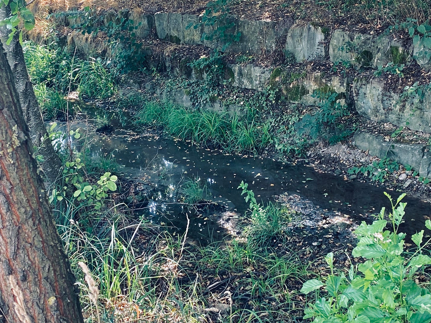
One of those thousands of smaller rivers, the Syr, runs very close to my house. It’s a ten minute bike ride from my home, and I cross it twice whenever I ride to a nearby train station to go into Luxembourg city. When last I looked at it, it’s become not much more than a thin creek.
Across the street from my house is the Roudemerbaach, a large stream that feeds the Syr. Not far from it is the Faaschtbaach and the Aesselbaach, smaller streams which feed the Roudemerbaach just at the point where an old mill stands. That mill, where Earnest Hemingway stayed during World War II, once ground wheat for this and several other villages nearby, but it’s been at least a hundred years since any of these streams were regularly strong enough to push a mill wheel. Only parts of the Roudermerbaach have any water in it right now, and this is because it has been reforested in places.
The reason all these other streams and the larger rivers are empty is generally called “climate change,” but that’s not really correct. There’s been no significant rain for the last few months, and that is because of changes in the climate, but there’s a step in between rainfall and flowing streams that is just as crucial—the forests.
II. The Charcoal Forest and the Anthropocene
On our visit to his family in Limburg, my husband and I also visited Maastricht, a city named after the river upon which it sits (the Maas, or Meuse in French). Maastricht is not very far from a city best described as its evil Belgian twin Liège, where the largest part of the industrial revolution on the continent took place.
The story of the industrialization of Belgium is a long one, and rather tragic, and very heavily influenced by English industrialists. Many of the small towns in Wallonia look an awful like old English mining and factory towns for precisely this reason, and they are all in deep poverty and decline. I mentioned once that you can tell immediately when you’ve crossed the border between Luxembourg and France—without looking at street signs—by how much trash litters the side of the road. It’s the same when you pass between Belgium and the Netherlands, but even more startling.
I once joked with my sister—who lives also in the Ardennes with me—that Belgium is the “Ohio of Europe” and she immediately agreed, laughing. I said this without malice (after all, I was born in Ohio), but I hadn’t until this trip really understood why this was so. Just as the deeply beautiful, ancient mountains of Appalachia were raped and then later trashed to fuel the factories of the rust belt, the Ardennes were likewise violated and for similar reasons.
That violation is a little older, however. An ancient name for a particularly thick region of the Silva Arduenna in what is now Belgium was the Silva Carbonaria: the “Charcoal Forest.” Precisely when it was first known as such is unclear, but the origins of its name most definitely come from the very old practice of creating charcoal from the wood of that forest for iron smelting.
Charcoal burns much hotter, much longer, and much more regularly than mere wood, and thus was essential for early industrial iron production. In the beginning, the factories and forges of Liège were fueled by the corpses of Arduinna’s cathedral giants until coal became cheap enough to mine and transport thanks to steam engines. Liège’s Dutch neighbor, Maastricht, could not compete with its capitalist iron and steel production, and was anyway too conservative to do so. Instead, Maastricht focused on pottery, textiles, and trade, none of which required nearly as much coal as the Belgian forges.
This is why there’s such a difference across the man-made border between Belgium and the Netherlands when you cross into Limburg, and also why Belgium looks so “trashed.” It’s because one region heavily industrialized very, very fast, while the other did so much slower and without fully transforming all its land and people into raw material for the capitalists.
This is of course the same story of Appalachia, and also of England. So many resource-rich places were transformed quickly into industrial and mining wastelands. Suddenly and for a short time, wealth flowed fast and wages were good; then, just as suddenly, the factories closed, the mines went dry, and the despoiled land became a trash pit and the towns places of deep despair.
There is often an argument about when precisely the “Anthropocene” started. The Anthropocene is a proposed geological time period during which certain climatic trends can be read in rock layers. Each geological time division—such as the Jurassic or Mezozoic, describe periods of time during which certain kinds of life were able to live and others were not on account of general climate conditions. Just as there are years, months, weeks, days, hours, minutes and seconds, this kind of division proposes eons, eras, periods, epochs, and ages to mark time of the earth itself.
The Anthropocene is a proposed epoch, a period of between several thousand years and a few millions of years, defined as a time during which human activity is the driving force affecting geological and climatic conditions. The arguments about the Anthropocene are rarely about whether or not the situation it describes is correct, but rather precisely when this started. Some attempt to date it at the beginning of human farming, or earlier to the period of extinction of larger vertebrates through human hunting (mammoths, etc). Others propose more recent events, such as the birth of human cities, colonial expansion of Europe into the Americas, the industrial revolution, or even the first atomic bomb.
Where one starts the Anthropocene has much more to do with ideology than with objective science, and there is even a question of whether or not the Anthropocene should be seen as an actual epoch or rather an “event.” In this second idea, rather than the Anthropocene being seen as long-term process, it’s proposed that we see human activity as an anomalous event (or series of events) just like “Great Oxidation Event” (during which several billion years ago the earth’s atmosphere suddenly had a lot of oxygen and aerobic life became the dominant form throughout the earth.)
Regardless, we all generally understand humans have deeply affected the climatic conditions of the earth through our activities, and that there have been specific moments where these affects have accelerated.
The industrial revolution is one such obvious acceleration, or rather a point of acceleration, and it’s much more complicated than just the birth of factories. The situation of the Silva Carbonaria in Belgium and the larger Ardennes reveals this quite well. Just before coal and steam became the new preferred method of fueling industrial activity, deforestation for the production of charcoal had reached a dangerous peak. In fact, coal only became thought of as a viable alternative precisely because charcoal production was getting more expensive: remaining forests were farther and farther away from urban centers because nearby forests had been already cut down.
III. Hunger Stones and Floods
A short walk from my house, crossing several currently bone-dry stream beds, there’s an old forest path called rue de bois (the wood road). It was along this path that loggers hauled the massive corpses of trees to a large saw mill. Much of that wood was first turned into charcoal until the forges changed to coal. Even after that switch, the sawmill kept working and the forests kept being felled, this time for lumber that would be sent down the Sûr and Moselle to merchants along the Rhine.
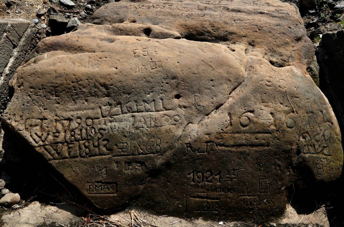
That’s the same Rhine which is now unnavigable for most and perhaps soon all commercial shipping, just as it was in 2018. It’s also the same Rhine where “hunger stones” have been revealed by receding waters, warning those who see them to grieve for the coming famine.
Hunger stones are messages carved into rock within rivers to mark drought. The opposite also exists: in many European cities, there are stone carvings marking high water marks during floods.
We tend to have a short memory for both droughts and floods alike, which is why such stones exist. They aren’t prophecies, but rather historical records and warnings. A hunger stone is a reminder from a moment when the river once got this low because of drought, and things were really bad for everyone. A flood marker says the same: once rains were so severe the river rose this high, and anyone within this level was flooded.
Speaking of floods: 44 millimeters (1 3/4 inch) of rain recently fell in the space of an hour over Paris, an amount so severe that several Metro stations flooded. This is the sort of event one generally expects in areas subject to monsoons.
This is where memory gets very difficult. Perhaps you remember this essay from mid-July of last year, in which I wrote the following:
I watched as the rivers rose around us, staring in particular awe at the force of the Prüm as we crossed it. Just before it joined the Sauer, its waters seemed to jump straight upward as if they came from deep within the earth itself. It was both beautiful and terrifying to watch, and it boded poorly for the fate of this friend’s village, but nevertheless, seeing such power, three words escaped my lips:
“Hail to you,” I said.
Everything around us is dry now, but a little more than a year ago, everything here was covered in water. The Rhine and its many tributaries flooded, causing many deaths and staggering economic destruction. We had flooding in our house and counted ourselves fortunate that this was all we had.
The severe droughts and the severe rains are of course linked, but again there is an intermediary step between the climate and its effects we often forget. That step is the forests, or rather their absence.
Forests act like sponges, absorbing rainfall and slowly releasing it over a long period. The more forest a watershed region has, the less extreme severe rain and severe drought will be. Were the original forests still here, many more of these streams would still likely have water, meaning the great rivers they feed would be less dry. Had that forest been here last year, the torrential rains would have been slowed on their descent to the river by plants and soil eager to hold it for a little while. With enough forests, the flooding would have been more gradual and less catastrophic.
I think this is what gets missed in the paralyzed panic about climate change. We cannot actually stop the larger processes industrialization has set into motion. It’s wasted effort to pretend otherwise, and it leads to all kinds of absolutely delusional fantasies about carbon capture technology. Likewise, the hope that we could transition to nuclear in some safe way is shown ridiculous by the mere fact that these increasing droughts can stop nuclear power plants for months.
The “collapse” has already started and cannot be stopped. But it can be eased a bit, and some of its effects can be made less catastrophic. Reforestation is one of those ways, an answer so ridiculously simple that I suspect that’s why no one ever takes it seriously. It comes with costs, of course, not really in labor but in the conversion of residential and agricultural land back to forest land. No one will want to do that, of course, and no one will want to pay for it, but eventually it will happen anyway.
There’s a weird climatic event during the early days of American colonization that explains how. It’s ugly, and it’s not something anyone likes to talk about, but there was actually a Anthropocenic reduction in atmospheric carbon dioxide that occurred before the birth of industrialization.
That event is called the Orbis Spike, and it is dated to 1610. That year saw the beginning of a short but remarkable drop in atmospheric C02 throughout the world, as recorded in ice sheets. What happened was that a lot of carbon was suddenly sequestered (stored or captured) from the air back into plants and especially trees, and this was because forests were suddenly growing again.
Unfortunately there’s a tragic reason for the regrowth of those forests: smallpox. Following its introduction to native populations in the Americas, it killed an estimated 50 million people. Those people were primarily indigenous farming people, and because they died the land they farmed began to become forest again. In other words, the Orbis Spike event, which is one of the theoretical birthdates of the Anthropocene, was caused by widespread human death.
It’s a terrible—no, hideous—truth that the mass death of humans is a boon for forests. Of course, the Orbis Spike was only temporary since what later replaced those dead indigenous farmers were industrial agriculturalists. Had the 50 million dead been from Europe or at least included the class of people who would later birth capitalism, perhaps the forests—and the rest of humanity—would have had an even better time of it.
The point here isn’t to praise colonial slaughter (far from it!) but rather to note that the forests will do quite well if a lot of us die. In other words, they’ll come back regardless if we bring them back purposefully through reforestation or if we let millions of people die from the droughts and floods made deadlier by their absence.
Either path there is possible, but of course I’m hoping for the one where don’t see mass death. No, I don’t know precisely how we get there, but I’m pretty certain it’s got everything to do with seeing the sacred again.
III. The Forest of Fake Unicorn Horns
And on the matter of the sacred: I learned just today that a significant part of Brocéliande is now ash.
Brocéliande, or the Fôret de Paimpont, is a relatively small woodland in Northwest France. Like many other forests, it was once part of a much vaster forest which covered most of Bretagne, Normandy, and likely included still extant forests in Central and South-Western France.
Brocéliande is really quite small as far as forests in other places go, but France has so few large forests left that the 9000 hectares (35 square miles) of the Fôret de Paimpont gave it some significance. There are at least 400 fewer hectares of it now. From the accounts I’ve read, the parts that are gone are mostly along one of the major tourist routes through the forest, including the area around a fabled set of fallen megaliths called the Tomb of the Giants.
Forest fires happen, and are natural occurrences. Also, there have been much larger fires raging throughout France consuming much bigger areas of forest. This forest, however—well, this kind of hurts.
Brocéliande is a funny place, full of what I like to call “fake unicorn horns.” I take the idea from Peter S. Beagle’s The Last Unicorn, in which a witch running a traveling magical circus captures the last unicorn for her spectacle. There is one problem, though—since only the pure at heart can actually see her as a unicorn, the witch creates a magical illusion so that people who cannot see the real one will still feel like they’ve seen a unicorn.
Brocéliande’s fake unicorn horns are everywhere in the names of places within it, helpfully pointed out to tourists with overwrought mythical signs. After the Tomb of the Giants you ascend a steep hill to Merlin’s Step and Vivian’s Tomb, before descending into The Valley of No Return and passing The Faerie Mirror until you come out of the forest and see a tree tastelessly painted gold. It’s a tourist trap for new agers and neo-pagans, complete with a small nearby village filled with chintzy “magic” shops selling Chinese-made resin statues of fairies, polished and often mislabeled crystals, and books on energy healing.
Brocéliande was very likely a real forest, and quite likely the name of the entire forest that covered Bretagne before the Bretons arrived from Britain. If so, the fôret de Paimpont is one of the last remaining vestiges of that forest, but none of those names—all pulled from Arthurian legend—have any connection to the places they supposedly describe.
Yet regardless, those places have deep magic. I’ve (illegally, since wild camping anywhere in France is against the law) spent the night there, and done rituals there, and seen things there I can never unsee. The fake unicorn horns often point to real ones, but you have to stop looking to finally find what’s staring you in the face.
That’s how it is, though. The sacred is often staring you in the face, and you rarely see it unless someone else points you there. Look at this map again, the one of the Rhine watershed:
It’s not just a map of a river and its myriad of tributaries, but also an image of a goddess and her almost countless younger sisters. I live within a kilometer of five of her tendrilled branches, and two kilometers from the stream they later join. That stream later joins the Moselle and then joins the Rhine, but what matters most is the parts of her directly in front of my window and those other parts a short walk away. Those are the parts of her sacred self I can see, and work for, and work along with.
All these streams once wore the forest clothing of Arduinna and laughed through her forests out towards the sea. Arduinna is mostly gone, the Ardennes a fading memory of a vast ocean of trees. Fading, but not faded, not gone.
We cannot make the rains come, nor can we stop them from coming, nor can we stop industrial capitalism or climate change. We cannot undo the terrible legacy of the factories, the slaughter of ancient forests for charcoal and then for coal mining. We cannot bring the sacred back to the entire world and undo what awful things its absence has left us with.
But we can help the sacred where we are, help the forests and streams where we live, and maybe show others how to do so, too. Maybe people need some fake unicorn horns on those places for a little while, shrines and markers pointing to a sacred they cannot quite see. Many of the oldest remaining oaks in the Ardennes are host to virgin shrines where old Catholic women still go to pray. No one will cut those down for fear of offending God, the Church, and especially their mothers and grandmothers. So the sacred trees remain adorned with fake horns…but they remain.
This may not be a satisfying answer to some, but it’s all I’ve got in me. The drought parches my soul as it parches the land, but again: there are still some streams flowing. They are the ones replanted with trees and river-bank plants allowed to grow wild again, streams which run through forests allowed to be themselves again rather than the “managed” areas full of lines of trees.
It’s possible, anyway. It already happens in some places. It can happen in others. And maybe one day the goddesses will be clothed again in the raiments they once knew, and maybe even without too many more deaths to make that happen.


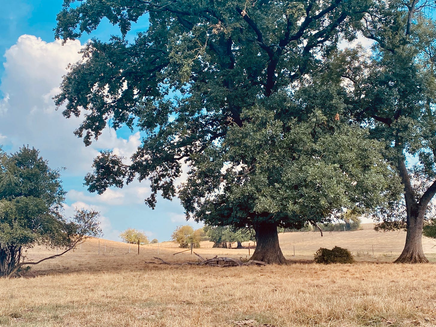



The photo of the oak in dry grass looks like the dry summer oak savanna In my part of California.
I used to go often to the Ardennes, to Epen and Slenaken in the Netherlands, and to St. Hubert and La Roche en Ardennes in Belgium, to hike and get away from busy Amsterdam. This was between 1995 and 2005. Back then, summers were not as hot or as dry. But autumn and winter are the best times to go to the Ardennes. It’s quieter and more mysterious. Sitting in front of a wood fire eating champignons and wild boar with a glass of Duvel is my idea of a perfect Ardennes autumn dinner.